shape
carat
color
clarity

Dorian...Keeping an eye out

Arcadian

Ideal_Rock
Premium
Joined
Sep 17, 2008
Messages
9,086
If anyone still cares, Dorian is now Post tropical but hit Canada with the force of a Cat 2.
Some discussions

Post-Tropical Cyclone Dorian Discussion Number 59
NWS National Hurricane Center Miami FL AL052019
500 PM AST Sat Sep 07 2019

Satellite imagery and surface observations indicate that Dorian has
lost tropical cyclone characteristics and is now a hurricane-force
extratropical low. The initial intensity is held at 85 kt based
mainly on the earlier scatterometer data.

The initial motion is 040/26. Strong mid-latitude southwesterly
flow should steer Dorian across Nova Scotia and other portions of
eastern Canada during the next 24-30 h. After that, the cyclone
should turn east-northeastward over the far north Atlantic, with
this motion continuing for the rest of the system's life.
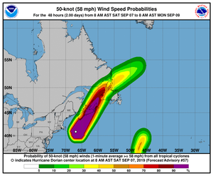
204746.png
 

Garnetgirl

Ideal_Rock
Joined
Dec 7, 2014
Messages
2,140

Arcadian

Ideal_Rock
Premium
Joined
Sep 17, 2008
Messages
9,086
Thanks for the update, @Arcadian Dorian may have left the USA, but is not over yet.

I’m still watching, as I have friends in Newfoundland, and Nova Scotia.

Also friends who are vacationing on Prince Edward Island, and a couple whose yacht is moored in Halifax Harbour.

Apparently there are about half a million people without electricity in the Atlantic provinces. It looks pretty bad:

https://www.cbc.ca/news/canada/nova-scotia/hurricane-dorian-nova-scotia-destruction-1.5274887


I hope your friends are ok through this. I've gotten to see some footage and its not at all pretty.
 

Arcadian

Ideal_Rock
Premium
Joined
Sep 17, 2008
Messages
9,086
This is from the canadian weather center
https://weather.gc.ca/hurricane/statements_e.html
https://weather.gc.ca/hurricane/technical_discussion_e.html#fxcn31
(I haven't seen any graphs unfortunately) *edit* found it!!
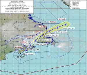
dorian_canada_track.png
For Post-tropical Storm Dorian.

The next full information statement will be issued by 3.00 a.m. ADT.

The center of Post-Tropical cyclone Dorian tracked across central Nova Scotia this evening and is currently located over the eastern Northumberland Strait. Dorian will continue to track into the Gulf of St Lawrence overnight with powerful winds and heavy rainfall. Strong winds will very slowly diminish overnight over the southwestern Maritimes.

1. Summary of basic information at 12.00 a.m. ADT.

The center of Post-Tropical Dorian was located near latitude 46.3 N longitude 62.1 W or about 120 km east of Charlottetown PE. Dorian still an intense Post-Tropical cyclone with maximum winds estimated at 75 knots...140 km/h and central pressure at 960 mb. Dorian is moving northeast at about 23 knots...43 km/h.

2. Summary of latest information.

By late this evening there were over 500,000 power ouatges across Nova Scotia, New Brunswick, and Prince Edward Island. There have been countless reports of downed or uprooted trees, a large construction crane has collapsed in downtown Halifax, and storm surge flooding in several Atlantic coastal areas including Halifax Harbour, and along eastern coastlines in New Brunswick.

Very strong winds have now moved into Prince Edward Island, Iles de la Madeleine, and western Newfoundland. Summerside PE recently reported a wind gust of 115 km/h, Iles de la Madeleine QC recently gusted to 120 km/h, and Stephenville and Port Aux Basques NL recently gusted to 104 km/h and 124 km/h respectively.

Many reports of heavy rainfall of 75 to 150 millimeters were observed over western half of Nova Scotia, southeastern New Brunswick and western Prince Edward Island.

Some offshore buoys reported wind gusts as high as 150 km/h and peak waves over 20 metres.

Forecaster(s):Borgel/Hatt
 

Garnetgirl

Ideal_Rock
Joined
Dec 7, 2014
Messages
2,140
I hope your friends are ok through this. I've gotten to see some footage and its not at all pretty.

Thank you for your good wishes, @Arcadian. You are very kind. :saint:
Hubby and I have been in touch with our friends, and thankfully they are all OK.
 

Garnetgirl

Ideal_Rock
Joined
Dec 7, 2014
Messages
2,140
This is from the canadian weather center
https://weather.gc.ca/hurricane/statements_e.html
https://weather.gc.ca/hurricane/technical_discussion_e.html#fxcn31
(I haven't seen any graphs unfortunately) *edit* found it!!
dorian_canada_track.png
For Post-tropical Storm Dorian.

The next full information statement will be issued by 3.00 a.m. ADT.

The center of Post-Tropical cyclone Dorian tracked across central Nova Scotia this evening and is currently located over the eastern Northumberland Strait. Dorian will continue to track into the Gulf of St Lawrence overnight with powerful winds and heavy rainfall. Strong winds will very slowly diminish overnight over the southwestern Maritimes.

1. Summary of basic information at 12.00 a.m. ADT.

The center of Post-Tropical Dorian was located near latitude 46.3 N longitude 62.1 W or about 120 km east of Charlottetown PE. Dorian still an intense Post-Tropical cyclone with maximum winds estimated at 75 knots...140 km/h and central pressure at 960 mb. Dorian is moving northeast at about 23 knots...43 km/h.

2. Summary of latest information.

By late this evening there were over 500,000 power ouatges across Nova Scotia, New Brunswick, and Prince Edward Island. There have been countless reports of downed or uprooted trees, a large construction crane has collapsed in downtown Halifax, and storm surge flooding in several Atlantic coastal areas including Halifax Harbour, and along eastern coastlines in New Brunswick.

Very strong winds have now moved into Prince Edward Island, Iles de la Madeleine, and western Newfoundland. Summerside PE recently reported a wind gust of 115 km/h, Iles de la Madeleine QC recently gusted to 120 km/h, and Stephenville and Port Aux Basques NL recently gusted to 104 km/h and 124 km/h respectively.

Many reports of heavy rainfall of 75 to 150 millimeters were observed over western half of Nova Scotia, southeastern New Brunswick and western Prince Edward Island.

Some offshore buoys reported wind gusts as high as 150 km/h and peak waves over 20 metres.

Forecaster(s):Borgel/Hatt


Once again, thanks so much for all the information @Arcadian. From what I understand, Dorian has now moved off to the sea. I hope that’s the end of him!
 

Karl_K

Super_Ideal_Rock
Trade
Joined
Aug 4, 2008
Messages
14,632
Wifey4vr's parents are in NS but are inland, they lost power for 10 hours or so and a bunch of trees down but they and their house is fine.
A friend on the family had 3 trees blown down on their house.
2 construction cranes were blown over and a under construction building was badly damaged in Halifax.
Docks, wharves and the shoreline damaged/destroyed in areas and some low lying areas near the coast flooded and damaged.
No lose of life reported so far that I have heard about.
 
Be a part of the community Get 3 HCA Results
Top